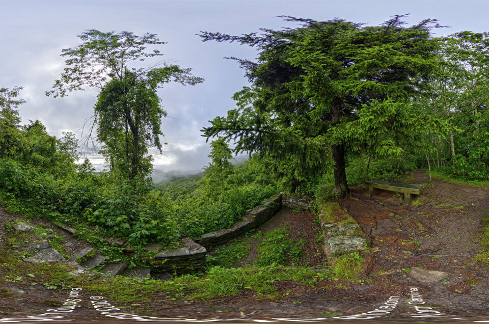
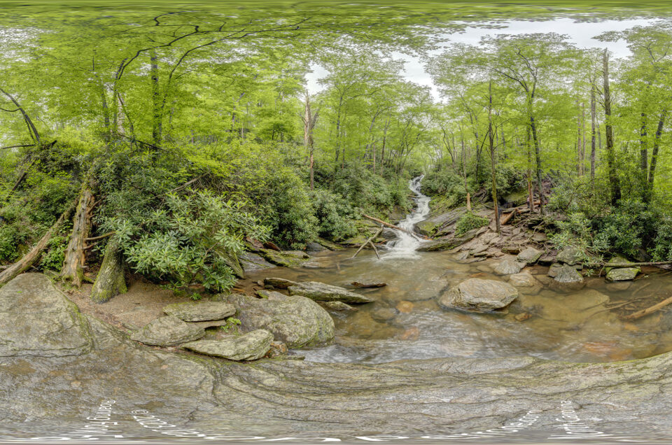
On June 15 2016 around sunset, I went out to Cocoa Beach to try and capture some aerial 360° images of our beautiful coastline at the Cocoa Beach Pier. The sunset results came out nice and you can view the interactive panoramic below. What do you think? You can leave your comments below.
Cocoa Beach, Florida Aerial Images
360° images on Google Maps Street View
Aerial images are not for sale.
Jason
Jason is a professional photographer who enjoys urban exploring, traveling, and photographing historical places.
Hello from Ocala
I really like your aerial panorama’s . Can you please share what equipment and software you are using to get them up on roundme.com . I have a P3P and would love to do some of these on the Rainbow River
Thank you for taking the time to reach out about the aerial panoramic images. I am using the DJI Phantom 3 pro as is out of the box. I downloaded an app to help assist with capturing the images needed to create the pano. I am using the Litchi app but there is another great one called Dronepan. Just depends on preference and device you use with your phantom. The Litchi apps is $25 in the play store and is worth it in my opinion. Never used the Dronepan app as at the time it was only for IOS. The app helps me capture 18-26 images with the phantom. Once I am back at the computer I use Autopano Giga by Kolor.com stitch my images into a spherical 360. I then have to import that image into photoshop so I can fix the zenith since the drone does not capture anything above the horizon. Once I am happy with the patch job, I then upload to round.me or I use Panotour Pro to create my own stand-alone virtual tour that I can then host on my server and track via Google Analytics.
Hope this helps.
Joseph Renda
June 19, 2016 at 1:20 pm
Thanks Jason.
I have the P3P ( two of them:) and the Litchi app so I’m off to a good start. I’ll go take a look at auto pano giga and then try to figure out the last piece of the puzzle in Photoshop. You’ve given me enough to work on. Thanks
Joe
jperrone
June 19, 2016 at 1:24 pm
You are welcome. If you are on Facebook there are private groups you can join that are very helpful.
Joe Renda
June 19, 2016 at 2:24 pm
Sounds good. We have a group with a few thousand drone pilots called DJI FREINDS Most in there are from florida.
If you can give me the names of two of the 350 pano type groups I’ll join. I’m always looking to do new stuff. I’ve done some sticking before, but it never looked as clean as yours.
Thanks again.
Joe
Also, if you like to travel to do some of your stuff. Let me know our river is unique because it’s so clear.
DronePan Community and Litchi App Users. I am always traveling for work and pleasure and really need to get my butt to the other coast of Florida. Always up and down 95 but never really hit the west coast. I just started flying the drone less than 2 weeks ago and I am having a blast learning all the new ways I can use the camera. Brings back memories from my skydiving days.


6 Comments
Hello from Ocala
I really like your aerial panorama’s . Can you please share what equipment and software you are using to get them up on roundme.com . I have a P3P and would love to do some of these on the Rainbow River
Hello Joe,
Thank you for taking the time to reach out about the aerial panoramic images. I am using the DJI Phantom 3 pro as is out of the box. I downloaded an app to help assist with capturing the images needed to create the pano. I am using the Litchi app but there is another great one called Dronepan. Just depends on preference and device you use with your phantom. The Litchi apps is $25 in the play store and is worth it in my opinion. Never used the Dronepan app as at the time it was only for IOS. The app helps me capture 18-26 images with the phantom. Once I am back at the computer I use Autopano Giga by Kolor.com stitch my images into a spherical 360. I then have to import that image into photoshop so I can fix the zenith since the drone does not capture anything above the horizon. Once I am happy with the patch job, I then upload to round.me or I use Panotour Pro to create my own stand-alone virtual tour that I can then host on my server and track via Google Analytics.
Hope this helps.
Thanks Jason.
I have the P3P ( two of them:) and the Litchi app so I’m off to a good start. I’ll go take a look at auto pano giga and then try to figure out the last piece of the puzzle in Photoshop. You’ve given me enough to work on. Thanks
Joe
You are welcome. If you are on Facebook there are private groups you can join that are very helpful.
Sounds good. We have a group with a few thousand drone pilots called DJI FREINDS Most in there are from florida.
If you can give me the names of two of the 350 pano type groups I’ll join. I’m always looking to do new stuff. I’ve done some sticking before, but it never looked as clean as yours.
Thanks again.
Joe
Also, if you like to travel to do some of your stuff. Let me know our river is unique because it’s so clear.
https://youtu.be/xUPfjqLgAYY
DronePan Community and Litchi App Users. I am always traveling for work and pleasure and really need to get my butt to the other coast of Florida. Always up and down 95 but never really hit the west coast. I just started flying the drone less than 2 weeks ago and I am having a blast learning all the new ways I can use the camera. Brings back memories from my skydiving days.