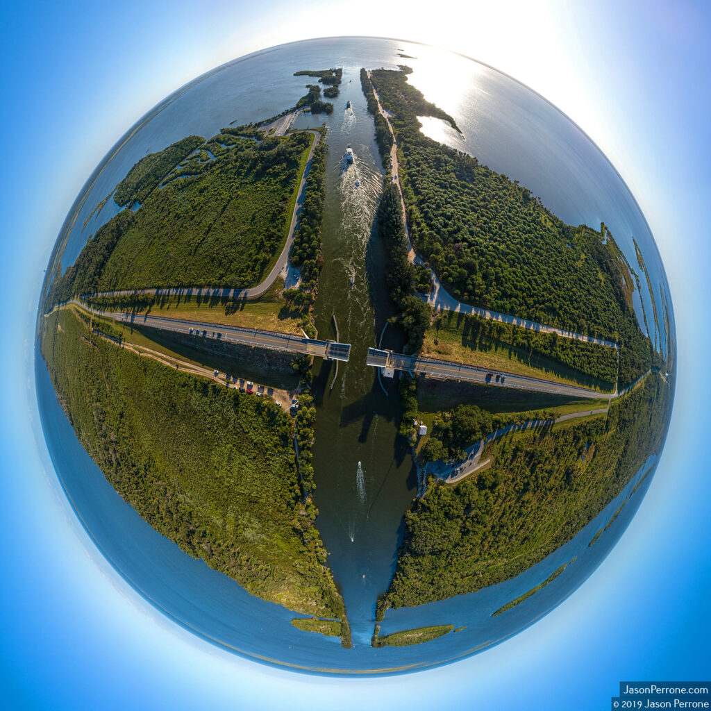
Aerial 360-degree Panoramic Image Above The Haulover Canal
On November 10th, 2019, my girlfriend and I decided to take a drive through the Merritt Island Wildlife Refuge since it was a beautiful day with the weather in mid to high 70’s. One of our many stops was at the Manatee Viewing Area at the historic Haulover Canal.
When we were getting ready to leave, I heard the drawbridge sound its horn to let people know the bridge was about to go up. Knowing this would look cool in an aerial view with the drone over the canal and bridge, I decided to get the DJI Phantom 4 Advanced out and get it in the air to snap a few aerial 360-degree photos while the bridge was up. To capture the aerial 360-degree panoramic, I took 34 images with a slight overlap to them, so I digitally stitch them together in a program called Autopano Giga.
You can see the resulting aerial 360-degree panoramic, as well as the stereographic, little planet, or sometimes called a tiny planet image below.

If you have any questions about the shooting process, please leave a comment below or send me an email through my contact page. Don’t forget to follow me on Facebook and Instagram.
About the Haulover Canal
The Haulover Canal is a waterway in the North end of the Merritt Island Wildlife Refuge and connects the Indian River to the Mosquito lagoon and is a historic location. It was added to the US national registry of historic places on December 19th, 1978.
According to the historical marker at the canal: “Native Americans, explorers, and settlers hauled or carried canoes and small boats over this narrow strip of land between the Mosquito Lagoon and the Indian River. Eventually, it became known as the “Haulover.” Connecting both bodies of water had long challenged early settlers of the area. Spaniards visited as early as 1605 and slid boats over the ground covered with mulberry tree bark. Early settlers used rollers and skids to drag schooners across. Fort Ann was established nearby in 1837, during the 2nd Seminole War (1835-1842), to protect the Haulover from Indians and carry military supplies from the lagoon to the river. In 1852, contractor G.E. Hawks dug the first canal using slave labor. It was 3 feet deep, 14 feet wide, and completed in time for the 3rd Seminole war (1856-1858). Steamboat and cargo ships used the passage until the railroad arrived in 1885. By 1887, the Florida Coast Line Canal and Transportation Company dug a new and deeper canal, which you see now, a short distance from the original. The Intracoastal Waterway incorporated the Haulover Canal as a federal project in 1927 to be maintained by the U.S. Army Corps of Engineers. Since then, the channel has been dug wider and deeper, and a basin added for launching boats.”


Leave a reply